
Michael Alexander
Growth-Focused Digital Marketer
SEO - Email Campaigns - UX Optimization
I help mission-driven and experience-based companies grow — using data, storytelling, and digital performance improvements.
Let’s build something impactful
Recent Results
+33% organic traffic across multi-brand ecosystem
+20% conversion rate improvement after key UX upgrades
45% email campaign open rates, above industry benchmarks
Top-10 keyword rankings for high-intent B2B and B2C search terms
Featured Work
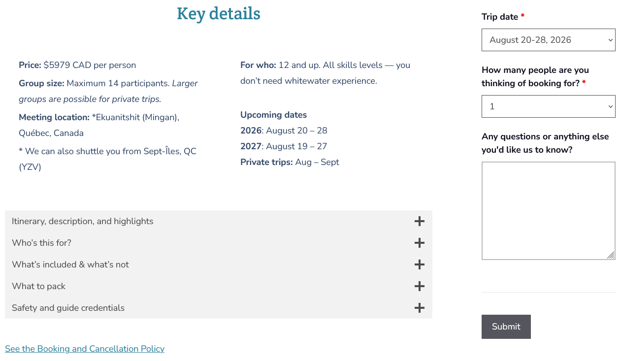
Content & Booking Clarity
Supporting high-consideration multi-day trips through UX improvements
Collaborated with leadership + SEO specialist to refine trip detail structure
Executed bilingual page updates, visuals, and metadata improvements
Helped visitors understand pricing, length, difficulty, and logistics
Outcome:
Increased clarity and decision-readiness for longer booking cycles
Email & SEO Growth
Performance improvements for technical training courses
Executed high-engagement email campaigns in Klaviyo & supported automated touchpoints
Led SEO + CRO improvements across 40+ product and collection pages
Strengthened pathways to help field professionals find and book the right course
Results:
+33% organic traffic
+20% conversions
45% open rates
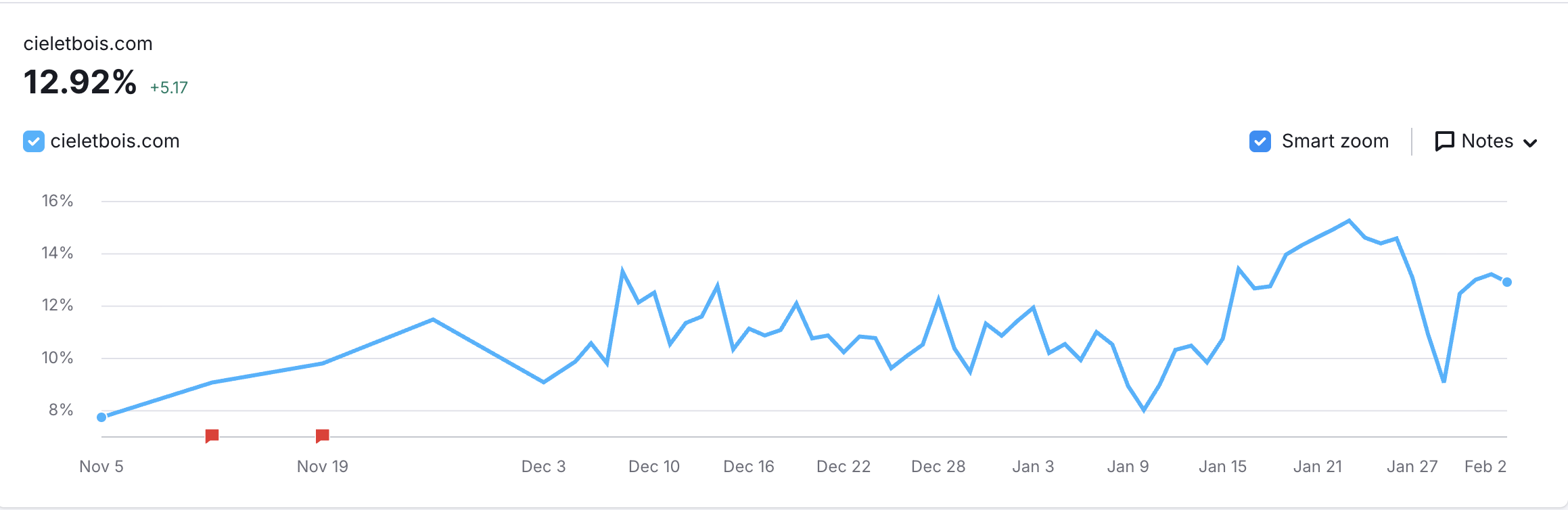
Corporate Retreat SEO Launch
Demand validation for a new B2B revenue stream
Supported SEO optimization, UX layout, and visual direction; managed full publishing
Targeted high-intent corporate retreat keywords
Results:
11,200+ search impressions
Top-10 keyword rankings
2:28 avg time-on-page
First inbound corporate group inquiries
Content Operations & Pipeline Growth
Designed a content-to-lead engine that consistently converted viewers into qualified ales prospects
Scaled and managed content operations through a distributed team of animators, voice, actors, and editors resulting in an overall 70% increase to sales prospects.
Outcome:
Created a $1.9MM sales channel by launching the company’s first content marketing strategy
Skill set
I apply this toolkit to drive real audience growth, improved engagement, and clearer conversion paths.
Technical
SEO (Search Console, GA4)
Email Campaigns (Klaviyo)
Shopify & WordPress publishing
Basic graphic design, photo & video editing (Adobe Creative Suite)
CRO & Website optimization
Strategic
Digital performance improvement
Content structure + UX for Education & Experiences
Data-informed decision making
Multi-brand coordination
Audience insight + messaging adaptation